Go to page

Bibliographic Metadata

Title
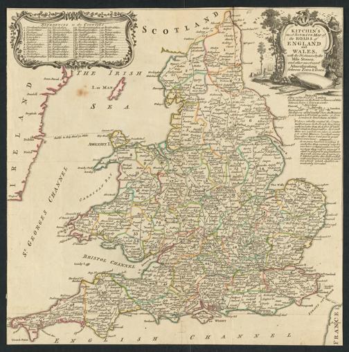
Kitchin's most Accurate Map of the Roads of England and Wales : with the Distances by the Mile-Stones, and other most exact Admensurations between Town & Town
Additional Titles
Most Accurate Map of the Roads of England and Wales
ContributorKitchin, Thomas
Published[London] : [Robert Dodsley] : [James Dodsley], [1764]
Pagination / Format1 Karte ; 34 x 34 cm : Kupferstich (koloriert)
Annotation
Enthalten in: England Illustrated, Or, A Compendium Of The Natural History, Geography, Topography, And Antiquities Ecclesiastical and Civil, Of England and Wales. 1764, Karte No. 1
Maßstab auf der Karte nicht angegeben. - Ohne Kartennetz und Randgraduierung
Titelkartusche oben rechts. - Erläuterungen rechts unterhalb der Titelkartusche. - Erklärungskartusche oben links
LanguageEnglish
Electronic Edition
Halle, Saale : Bibliothek der Franckeschen Stiftungen, 2026
URNurn:nbn:de:gbv:ha33-1-305715 
Links
Archive METS (OAI-PMH)
IIIF IIIF Manifest
Classification
License/Rightsstatement
Creative Commons Attribution - NonCommercial - ShareAlike 4.0 International License